Subject: Colonial United States
Period: 1768 (circa)
Publication: Atlas Universel
Color: Hand Color
Size:
24.5 x 18.8 inches
62.2 x 47.8 cm
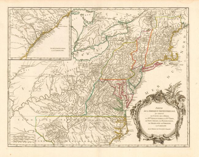
Beautifully engraved, large map of the eastern seaboard with a large inset at upper left that continues the main map from Cape Fear south through the Carolinas and Georgia to F. St. Georges. The map is based on the seminal map by John Mitchell, published in 1755, the same year this plate was initially engraved. The mapping of the trans-Allegheny and Great Lakes regions and in the interior of New England is of particular interest, for this shows some of the earliest accurate information of these regions incorporating data from the Mitchell, Evans and Fry-Jefferson maps. This is the second state with the final line below the title "Avec Privilege 1755" removed. The 1763 Treat of Paris boundary is shown as a dotted line. Pennsylvania extendes to take in most or present-day New York and in New England New-Hamp-Shire and Prov. De Sagadahock have been added. A handsome title cartouche engraved by Groux fills the Atlantic.
References: Cumming (SE) #295; McCorkle #755-37; Pedley #469; Sellers & Van Ee #718.
Condition: A
Very nice impression and original outline color printed on sturdy paper. Faint damp stain s in blank margins, well away from map.