Subject: United States
Period: 1839 (published)
Publication:
Color: Black & White
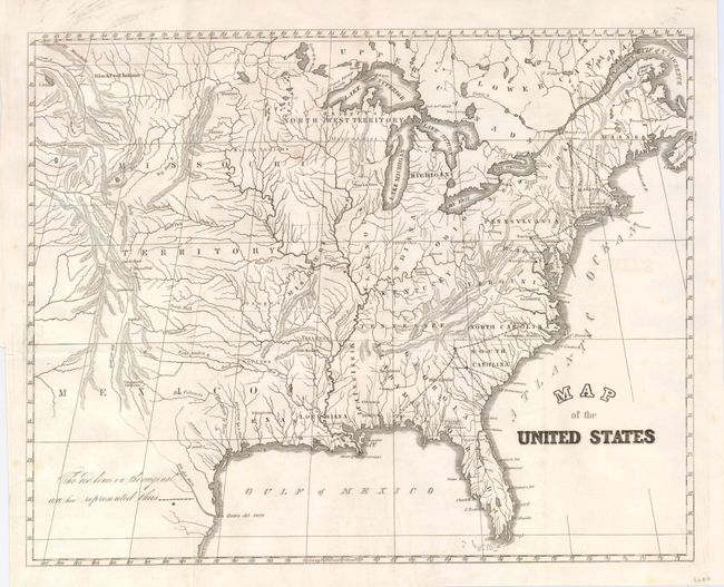
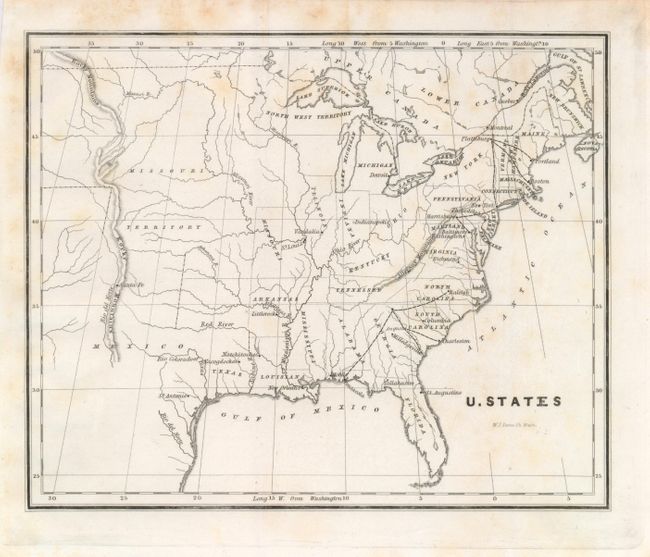
In 1838 Congress was alerted to the fact that the small size of the military forces created grave vulnerability to hostile coastal and interior threats. These two maps show proposed interior stations for troops to reinforce where they were most likely to be needed for coastal defense. Significantly, they reflected the availability of early railway systems that could be used to quickly transport the troops and their supplies to coastal locations. A fort is shown in the vicinity of St. Louis, but no other lines of communication are shown. Both maps locate the Republic of Texas. Lot includes:
1) Map of the United States. H.R. Doc. 2, 25th Congress, 3rd Session (14.5 x 11.6"), originally folded, now pressed. Map presents excellent detail of watershed. Delineates early railroads in the Northeast to as far south as Baltimore. Also details the railroads in the Carolinas, Georgia, and Alabama.
2) U. States. Sen. Doc. 1, 25th Congress, 3rd Session, W.J. Stone (engraver) Washington (8.5 x 6.8"). Smaller version shows the same information as the first map.
References:
Condition: B+
The first has a beautiful, early impression. It is very good with just one spot, printer's ink in upper margin. The second is good with a few foxing or toning spots, mostly at top.