Subject: Colonial United States and Canada
Period: 1756 (circa)
Publication:
Color: Hand Color
Size:
19.3 x 22.3 inches
49 x 56.6 cm
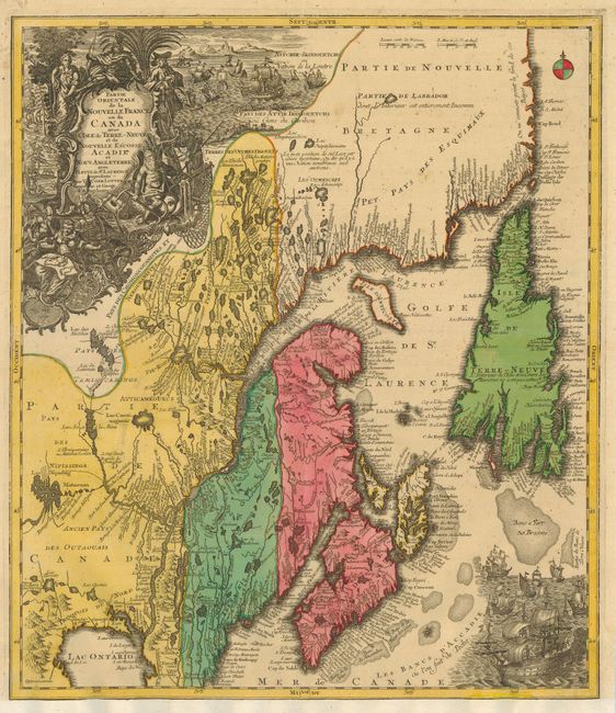
A beautiful map of Maine and northeastern Canada, including Nova Scotia, Labrador and Newfoundland. This is the second state of the map originally drawn by Seutter and engraved by Lotter, with Lotter's imprint in the title cartouche. The map's vertical format elongates the geography and distorts Newfoundland and shows the St. Lawrence River running nearly north-south. It is very detailed, especially along the coastlines and rivers with many place names noted, both European and Indian, including Casco Bay (Baye de Casco), the Penobscot River, Wells, and Cape Elizabeth. At bottom right is a scene with several sailing ships. At top left is a huge decorative title cartouche featuring allegorical figures, Indian chiefs, explorers, mapmakers, a fleet of ships, fishermen and wildlife.
References: Kershaw #344; Moreland and Bannister, p. 90; Sellers & Van Ee #278.
Condition: B+
Sharp impression and bold original color. Remargined at bottom with a small portion of the neat line in facsimile, and some worming in the lower portion of the main cartouche. Remargining is extended on verso to support short tear into ship at bottom with a few touches of facsimile There are a couple of repaired marginal tears, still an attractive example that would frame very well.