Catalog Archive
Auction 119, Lot 136

"[Lot of 2] Amer. Sep. Detroit de Davis. No. 10. [and] Amer. Sep. Partie du Groenland. No. 19.", Vandermaelen, Philippe Marie Guillaume

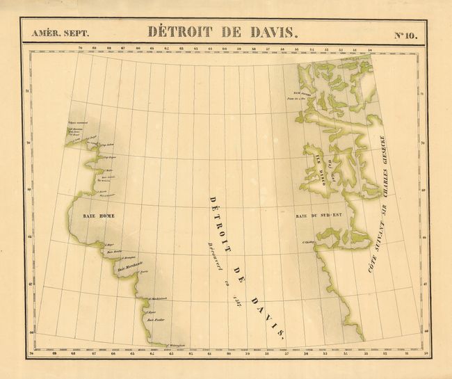
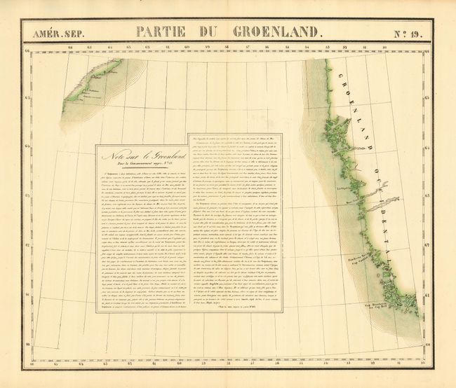
Subject: Arctic Canada and Greenland

Period: 1827 (published)

Publication: Atlas Universel de Geographie Physique, Politique, Statistique et Mineralogique

Color: Hand Color

Size:
22.6 x 18.7 inches
57.4 x 47.5 cm
Download High Resolution Image
(or just click on image to launch the Zoom viewer)

This interesting pair of maps detailing the western coast of Greenland and the Davis Strait. There is a note on the customs of the Eskimos filling the otherwise blank area on map 19. The Atlas Universel. was the first atlas to present all the maps on the same scale (1: 1,641,836), with each map covering an area of approximately 20 degrees longitude (from Paris) and 6 degrees of latitude. It was also considered to be the first lithographic atlas ever published. The maps were meant to be joined together to form a huge globe measuring 7.775 meters in diameter. There was only one edition of the atlas, published in 1825-27, and the subscription list shows that only 810 copies were sold

References:

Condition: B

With original outline color. There are a couple of spots of foxing and some short tears in the blank, generous margins.

Estimate: $200 - $300

Sold for: $150

Closed on 5/9/2007

Archived