Subject: Canada - Arctic
Period: 1772 (published)
Publication: Diderot's Encyclopedie (Supplement)
Color: Black & White
Size:
10 x 15.5 inches
25.4 x 39.4 cm
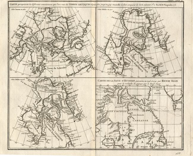
When Charles Joseph Panckoucke took over publication of Diderot's Encyclopedie in 1768, he promised to correct the cursory treatment of geography for which the first seventeen volumes had been criticized, with emphasis on the discoveries of the last 25 years. He employed Samuel Engel, a Swiss geographer, to write a series of articles about the northern regions and Didier Robert de Vaugondy to prepare ten maps to illustrate them. Engel rejected the De la Fonte Northwest Passage discoveries and believed the most sensible route from the Atlantic to the Pacific was along the north coast of Siberia. These maps illustrate the discoveries and various cartographic theories concerning the Pacific Northwest, East Asia and the North Pacific Ocean and include some of the most interesting comparative cartography of the eighteenth century
Fascinating group of four maps on one sheet illustrating the cartography of Sanson in 1650, Delisle in 1700 and 1703 and that of the famous Arctic explorer Henry Ellis in his quest for a Northwest Passage via Hudson Bay in 1746-47. All of the maps depict the Hudson and Baffin Bay region, showing the development of the region's cartography between 1650 and 1747.
References: Kershaw #477; Pedley #24.
Condition: A
Issued folding, now pressed. There are some minor repairs in the top margin, not affecting the map.