Subject: Canada - Hudson Bay
Period: 1753-1782 (circa)
Publication:
Color: Hand Color
An attractive pair of maps focused on Hudson Bay.
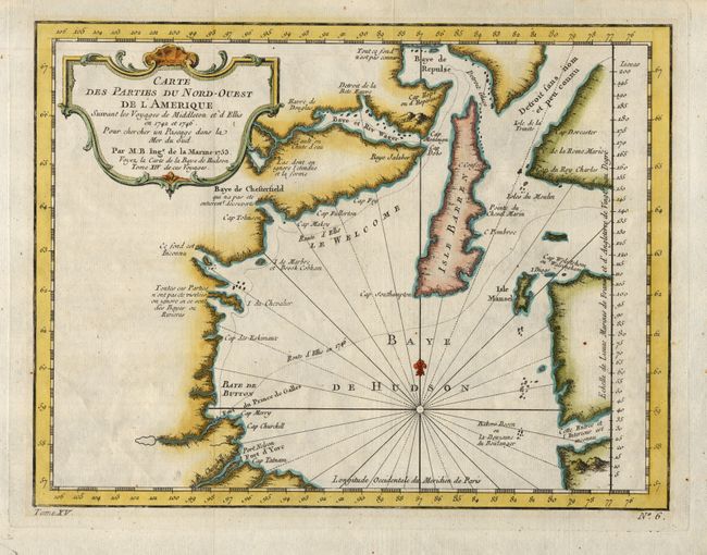
1)Carte des Parties du Nord-Ouest de l'Amerique Suivant les Voyages e Middleton et d'Ellis en 1742 et 1746… is a very nicely engraved, small chart covering most of Hudson Bay. It locates Fort Prince of Wales and Fort York, the Ottawa Islands (here the Bakers Dozen), the track of Henry Ellis in 1746, Repulse Bay, Buttons Bay and more. Middleton explored Wager Inlet, Repulse Bay and the northern part of Roes Welcome in search of a Northwest Passage via Hudson Bay in 1746. Published by Jaques Nicolas Bellin in Histoire General des Voyages…, dated 1753 (10.8 x 8.3")
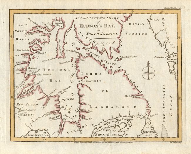
2) New and Accurate Chart of Hudson's Bay, in North America is an attractive, small map describing the James and Hudson Bays, the St. Lawrence, part of Nova Scotia, Labrador, Hudson Strait, Repulse Bay, and Greenland. There is a hopeful, but spurious, New discover'd Sea located on the western coast of Labrador. The map is decorated with a compass rose. This map was created by John Lodge for publication in the Political Magazine of 1782. Size is (9 x 6.9").
References: Map 2) Jolly POL-64.
Condition: A
1) Attractively colored with just a few tiny spots of foxing, mostly confined to blank margins. 2) Nicely colored on good paper with plenty of margin. Slight print blurring at the bottom. Hinge remnants in the blank margins at top.