Subject: North America
Period: 1850 (circa)
Publication:
Color: Hand Color
Size:
10 x 13 inches
25.4 x 33 cm
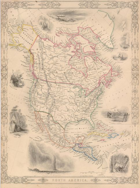
Similar to Tallis' map of North America, this map has different vignettes: Capt. Perry wintering in the Arctic Regions; White Bears; Hunting the Buffalo; Indian Chief (after Catlin); Falls of Niagara; Geysers, Iceland; Whale Fishery; First Landing of Columbus and Remains of Ancient Temple, Mexico. The map features a pre-Gadsden border. In the United States the map names only Oregon Territory, Missouri Territory, California, Texas and Florida. It has very good detail of the watershed with many rivers named. Locates many towns and settlements, and shows an extensive railroad system in the east. New Mexico is in a small, early configuration between Texas and the large region of California. Alaska is Russian Territory and Canada is British Territory. In the Caribbean the Bahamas and Antilles are well shown. Very fancy border and title cartouche.
References:
Condition: B
Fine, original outline color. The map is close trimmed along left margin, just into the border.