Catalog Archive
Auction 119, Lot 96

"Bowles's New One-Sheet Map of America, Divided into its Kingdoms, States, Governmts. and other Subdivisions…", Bowles & Carver

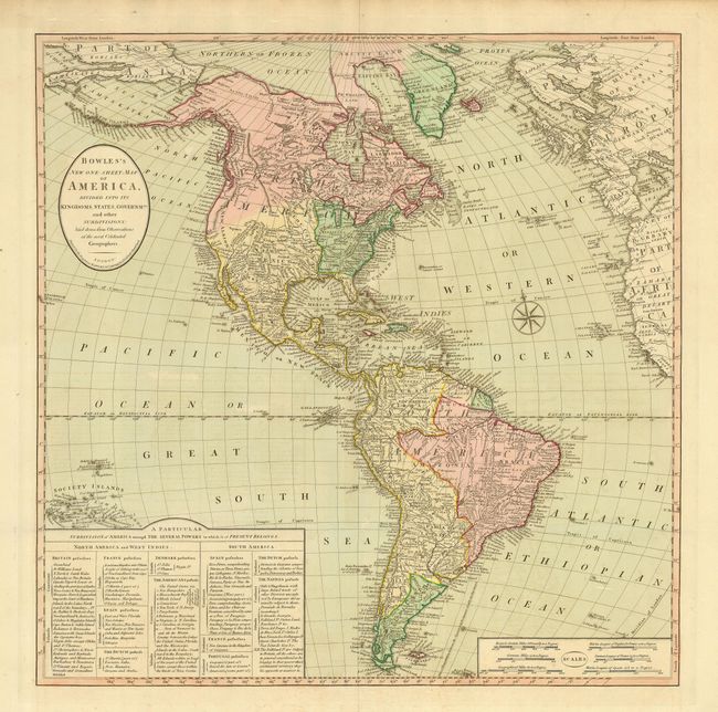
Subject: Western Hemisphere

Period: 1800 (circa)

Publication:

Color: Hand Color

Size:
22.2 x 22.5 inches
56.4 x 57.2 cm
Download High Resolution Image
(or just click on image to launch the Zoom viewer)

Handsome and very detailed map of the Americas with an extensive key to the colonial possessions. In North America the United States extends to the Mississippi River and there are 14 states listed. Spain is shown in control of New Mexico, Louisiana and Florida. The British possessions in Canada extend south on the west coast to San Francisco Bay. In South America, Spain and Portugal dominate the continent, but the Magallania region is shown to be in native hands.

References:

Condition: A

Good impression and superb original color. Two folds as issued with faint offsetting, still overall very good.

Estimate: $850 - $950

Unsold

Closed on 5/9/2007

Archived