Subject: Western Hemisphere
Period: 1791 (dated)
Publication:
Color: Hand Color
Size:
29 x 20.5 inches
73.7 x 52.1 cm
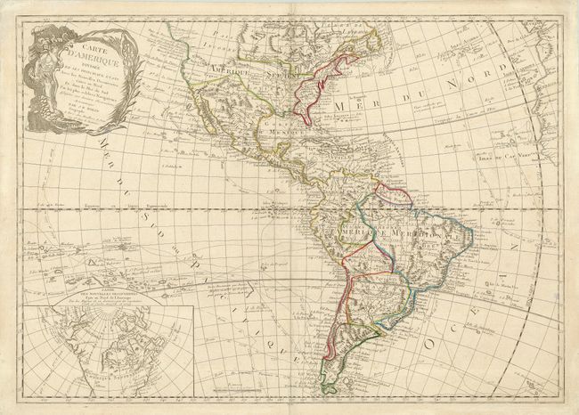
The era of exploration is dramatically shown on this rare map. It was first issued by Jean Baptiste Louis Clouet in 1787 with a slightly different title (Carte d'Amerique divisee en ses principaux Pays Dressee sur les Memoires les plus recents, et sur Differents Voyages). In this edition the plate has been revised to eliminate the erroneous Sea of the West and update the inset to reveal the discoveries of Captain Cook in the Pacific Northwest and Alaska. In North America, the young United States is shown to include Florida and Nova Scotia with a huge Louisiana Territory beyond. The tracts of explorers are shown, including Quiros, Le Maire, Magellan, Mendana, Bougainville, Furneaux and Cook. The decorative title cartouche features a female personification of America riding a particularly fierce alligator. Both states are extremely rare.
References:
Condition: A
Very good with a small stain near lower right border. The blank margin has a couple of filled wormholes.