Subject: Western Hemisphere
Period: 1700 (circa)
Publication: Atlas Contractus
Color: Hand Color
Size:
22 x 19 inches
55.9 x 48.3 cm
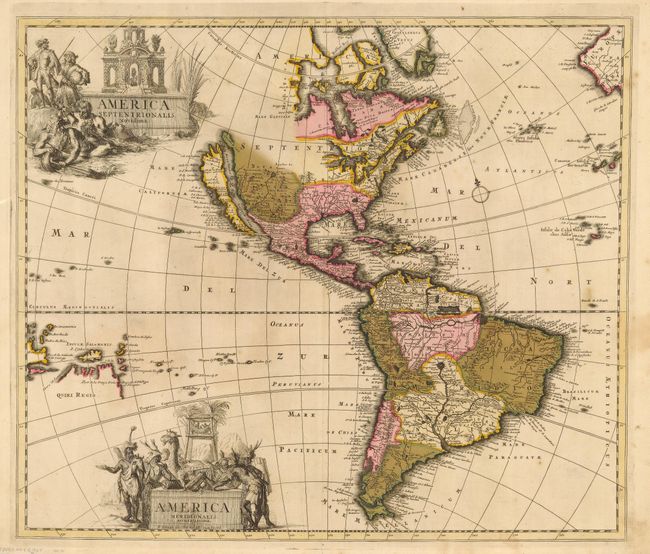
This is an extremely handsome map of the Americas with two large figurative title cartouches for each continent. North America is based on the Sanson-Jaillot model with California as an island, open ended Great Lakes and the R. del Norte (Rio Grande) flowing westward from a large inland lake located just north of Taos. Buttons Bay and the Great Lakes are both left open-ended in the west, leaving open the possibility of a Northwest Passage. In South America the mythical Prime Lacus stradles the equator, the Amazon River is shown as an elaborate network of waterways, and the Paraguay River has it headwaters in the spurious Xarayes Lake. Quiri Regio and Insule Salmonis are prominently featured in the Pacific.
References: McLaughlin #120; Tooley (Amer) p. 125 #56.
Condition: B
Sharp impression and original color with some oxidation that has been professionally reinforced on verso with light Japanese tissue.