Subject: Western Hemisphere
Period: 1550 (circa)
Publication:
Color: Hand Color
Size:
13.5 x 10 inches
34.3 x 25.4 cm
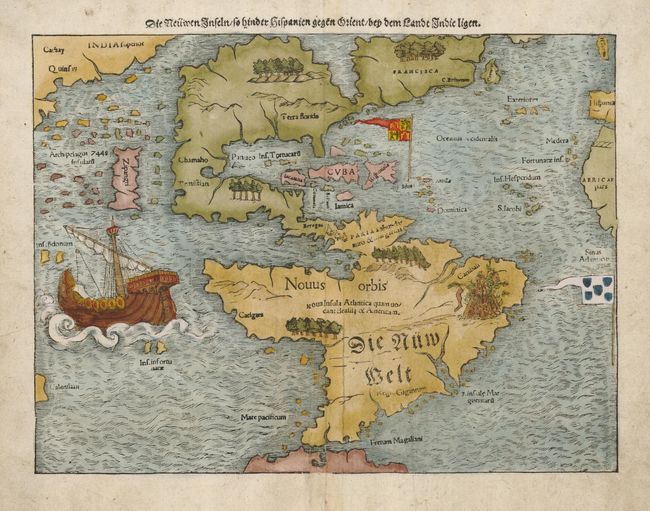
This is one of the most important 16th century maps of the New World, credited with popularizing the name America. North America is very oddly shaped with no California and 'Zipangri' (Japan) is shown only a short distance off the western coast. In the east, the land is nearly bisected by a body of water, known as the Sea of Verrazzano. The Yucatan is still shown as an island and the lake at Temistitan is connected to the Gulf of Mexico. South America has a large bulge in the northwest, the Amazon River is very short and cannibals inhabit the continent. The map is very decorative with Magellan's surviving ship 'Victoria' appearing in the Pacific. The flags of Spain and Portugal depict their respective spheres of influence in the New World.
References: Burden #12, state 5
Condition: B
Professionally backed with light Japanese tissue to support centerfold, with a bit of minor toning.