Subject: Cartographic Miscellany
Period: 1720 (circa)
Publication: Les Forces de l'Europe
Color: Hand Color
Size:
10.8 x 7.5 inches
27.4 x 19.1 cm
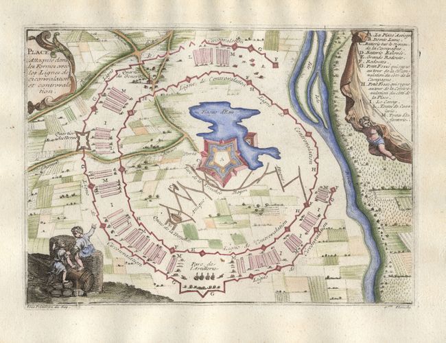
Nicolas de Fer held the title of geographer at Louis XIV's court. He was one of the most prolific publishers of plans of European cities in the late seventeenth century. The fortifications plans in Les Forces de l'Europe were designed to teach fortification techniques. Engraved by Van Loon and Schoonebeek after French engineers under the command of Vauban, the renowned military architect. The illustrations often include a description and a legend with the principal buildings; each city plan includes both fortifications and street layout.
An uncommon plan for an idealized fortification showing what would be needed to withstand a siege, with many levels of protections in place including battlements, trenches, batteries and artillery. The fortification surrounds farms and fields as well as a small lake within the walls. The plan is accented with putti and children as well as decorative cartouches for the title and the numbered key.
References: Pollak #21, p. 40.
Condition: A
Lovely, later color with some show through on verso.