Subject: World
Period: 1669 (dated)
Publication:
Color: Hand Color
Size:
22.3 x 16 inches
56.6 x 40.6 cm
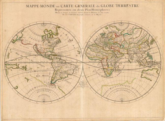
This simple, yet elegant map is based on Nicolas Sanson's world map of 1651. Nicolas drew this map for his 1660 atlas, and after his death in 1667, his sons Guillaume and Adrien used it in their atlases of 1669 and 1678. This edition shows Australia with a bit more definition, along with Tasmania and a small portion of New Zealand's coastline. This map is the first to indicate N. Danemarck west of the Hudson Bay, here named Mer Christiane. California is shown as an island, and Acoma and Santa Fe are noted in the Southwest, with Acoma shown correctly atop a mesa. The coastline of Asia is shown with the discoveries of the De Vries noted, including Terre de Iesso or Ieco, and a land called Yupi. The Great Lakes are not updated from the 1651 version, and do not show all five lakes. The map is typical of Sanson's "scientific" style of cartography with no decorative elements. It was published in conjunction with Pierre Mariette (father and son), who published many of Sanson's works after 1645.
References: Shirley #419.
Condition: B
Crisp impression and original outline color. The map has some light stains, toning and a few marginal tears, some just entering the map. Lower margin trimmed, with addition of paper to reinforce the right corner.