Antique Maps, Charts, Atlases and Globes for Sale at Auction

Old World Auctions - Antique Map Specialists


Antique Map Auction Sale No. 117 - closed 12/6/2006

Featuring 908 lots of rare antique maps, charts, pocket maps, globes and atlases
Prices Realized       Table of Contents       Search Auction


Lot #670: Carte Historique et Geographique des Royaumes d’Espagne et de Portugal…

Antique map chart Carte Historique et Geographique des Royaumes d Espa
Click to see full size image(s)

Estimate:
$275.00 - $350.00
Sold for: $240.00

Lot 670
By: Henry Abraham Chatelain
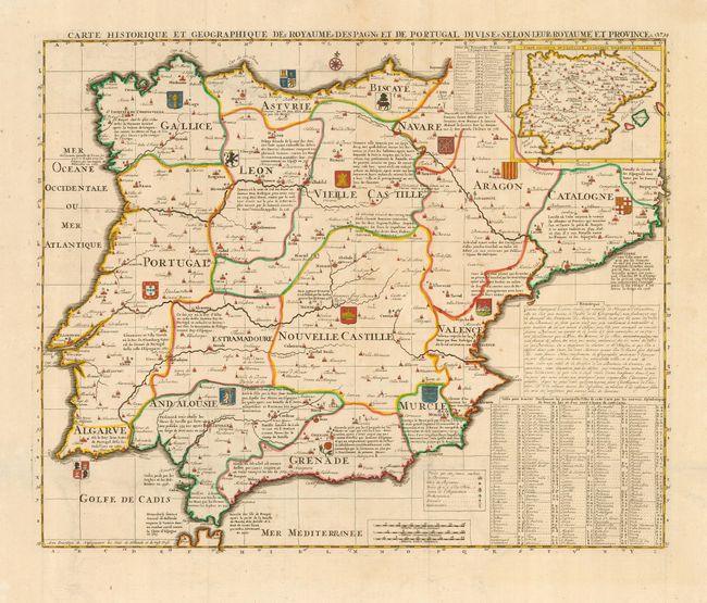
Subject: Spain & Portugal
Date: 1719

Publication: Atlas Historique

Condition: A
See Condition Guidelines

Color: hand color

Size: 20.5 x 17 inches
52.1 x 43.2 cm

Beautiful and very detailed map of Spain and Portugal. It includes the Straits of Gibraltar, and shows coats of arms and substantial details throughout the map. An interesting key at the bottom provides information on major cities, including those having universities, royal palaces, cathedrals and even those where the Inquisition was held.

Very attractive color with a short tear in the top blank margin.

See on Map Price Guide | See similar on Map Price Guide
Search this archived auction | Antique Map Price Guide