Subject: New England
Period: 1894 (dated)
Publication:
Color: Printed Color
Size:
36 x 26 inches
91.4 x 66 cm
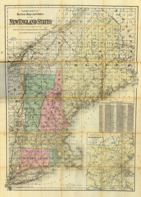
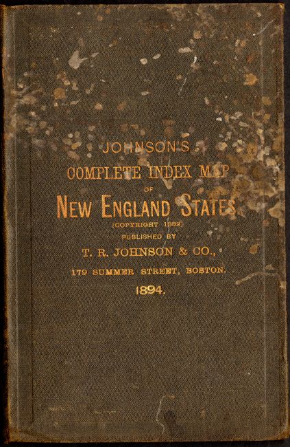
An apparently unrecorded map that includes a large inset map of "Eastern Portion of Massachusetts" and a table of distances. The map features Johnson's distinctive indexing system. Here the map is divided into 282 grids that is identical to the system used by today's Thomas Guides and other contemporary companies. The map is printed on thin banknote style paper and folds into gilt-stamped cloth covers. The 24 pp index is complete but loose from the binding. An ad on the inside cover promotes Johnson's map and his unique system of indexing with an explanation to its use. The map was drawn, engraved and printed by G.W. & C.B. Colton. We find no reference to this map.
References:
Condition: C
The map is fragile and nearly split down one fold. The covers are intact and lightly rubbed, but with some staining. The map should be professionally backed to support the fragile fold lines.