Subject: Poland
Period: 1716 (published)
Publication: Grosser Atlas
Color: Hand Color
Size:
22.5 x 19 inches
57.2 x 48.3 cm
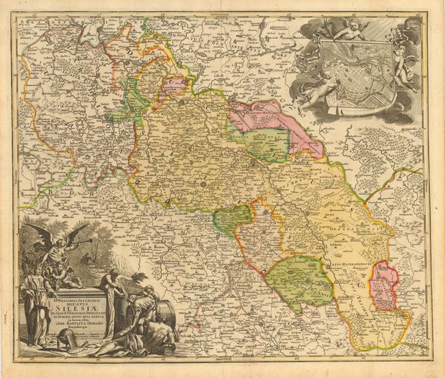
A large and finely engraved copper plate map that is centered on Schweidnitz. The map details the region at the confluence of the borders of today's Germany, Poland and the Czech Republic along the path of the Oder River. The fortified cities of Dresden, Prybus, Sagan, Crossen, Glogaw, Karnow, Opawa, Ratibor, Oppelen, Brieg, and more are named. The map is filled with fine detail throughout including mountains, watershed, roads, villages and towns. The large and very decorative allegorical cartouche is uncolored as issued, with cherubs and allegorical figures. At upper right is a large engraved view of "Breslaw" contained in a scroll cartouche held aloft by three putti floating in clouds.
References:
Condition: A
On a full sheet of ivory toned hand laid paper with original margins. A little marginal toning or spotting.