Antique Maps, Charts, Atlases and Globes for Sale at Auction

Old World Auctions - Antique Map Specialists


Antique Map Auction Sale No. 115 - closed 6/21/2006

Featuring 830 lots of rare antique maps, charts, pocket maps, globes and atlases
Prices Realized       Table of Contents       Search Auction


Lot #443: "Environs, de Dunquerke, de, Furnes, et de Nieuport" Nicholas de Fer

Antique map chart Environs de Dunquerke de Furnes et de Nieuport
Click to see full size image(s)

Estimate:
$140.00 - $180.00
Sold for: $100.00

Lot 443
By: Nicholas de Fer
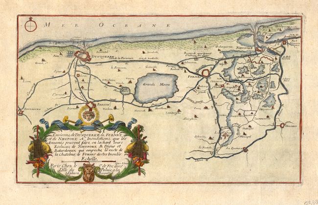
Subject: France and Belgium
Date: 1705

Publication: Les Forces de l' Europe…

Condition: A
See Condition Guidelines

Color: hand color

Size: 12.3 x 7.3 inches
31.3 x 18.6 cm

Fine chart displays the vicinity of Dunkerque and Niewpoort on the France/Belgium border. The map provides an excellent view of the rivers, lakes and canals, and the many fortifications in the region. Embellished with a nice title cartouche. Nicolas de Fer held the title of Geographer at Louis XIV's court. He was one of the most prolific publishers of plans of European cities in the late seventeenth century.


Ref: Pollak #21, p. 40.

See on Map Price Guide | See similar on Map Price Guide
Search this archived auction | Antique Map Price Guide