Subject: Oklahoma
Period: 1887 (dated)
Publication:
Color: Printed Color
Size:
32 x 24 inches
81.3 x 61 cm
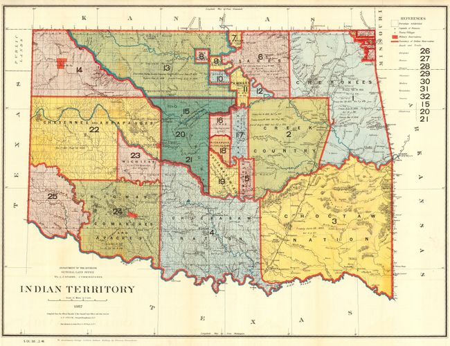
A most interesting and detailed map reflecting the status of lands allocated to various tribes shown through color-coding. Indian removals from their 'home lands' began as early as 1817 and in the years following many of the principal eastern Indian tribes were relocated to Indian Territory. Here the Five Civilized Tribes formed the nucleus of an organized government. By 1885, however, representatives of some fifty tribes had settled on lands once promised to the original five. This map reflects many of these allocations and provides some data on the pertinent treaties involved. Does not include the panhandle, which by this time are Public Lands. Drawn by G. P. Strum. Published to accompany George Catlin's Indian Gallery, by Thomas Donaldson. Photolithography by Julius Bien & Co., N.Y.
References:
Condition: A
The map features lovely color and bright impression. Issued folding, now pressed and backed with archival tissue. A hint of light toning or offsetting in blank areas, else fine.