Subject: United States - Mid-Atlantic
Period: 1864 (dated)
Publication: Valentine's Manual
Color: Hand Color
Size:
22.5 x 31.6 inches
57.2 x 80.3 cm
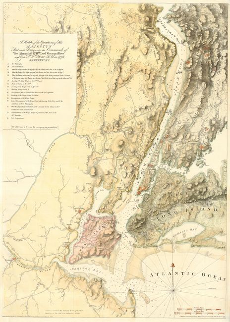
A nineteenth century reproduction of this important Revolutionary War period map, the chart shows the vicinity of New York City with superb topographical features, the troop placements and movements during the Battle of Long Island. It depicts navy positions off Staten island and in the harbor, up the East River and the Hudson. A table of numbered references is positioned in the top left under the title. This interesting chart was copied from the original Des Barres 1777 chart by George Hayward for Valentine's Manual in 1864. David Thomas Valentine was the clerk of the New York City Common Council from 1842 until 1867. The manual was an abstract of historical materials about New York City. Des Barres' original chart is now very scarce and rarely appears on the market.
References:
Condition: B
Issued folded, now pressed and backed with archival tissue. Some minor repairs of fold separations and a short binding tear. Binding trim replaced to accommodate framing.