Subject: North America
Period: 1755 (dated)
Publication:
Color: Hand Color
Size:
34 x 22 inches
86.4 x 55.9 cm
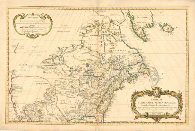
Large and uncommon chart covering nearly all of North America. The West is mostly blank with coastlines only partially delineated. Names the Sea of the West (La Mer de l'Ouest) but does not delineate it. Also shows a River of the West flowing west from Lake Winnipeg but ceasing near the Montagne de Pierre brillante suivant le report des Sauvages (mountain of brilliant stones as reported by the savages). Names explorers responsible for coastal discoveries. Good detail of rivers, lakes, Indian nations, and forts. Names all British Colonies but without political boundaries. The handsome chart is adorned with a large, beautifully engraved title cartouche and a second large cartouche containing the legend and three distance scales.
References: MCC #96-764.
Condition: A
Old repairs on centerfold and reinforcing paper edges. Bit of very faint offsetting, still overall very good.