Subject: North America
Period: 1745 (circa)
Publication: Tindal's Continuation of Rapin's History of England
Color: Black & White
Size:
18.5 x 14.8 inches
47 x 37.6 cm
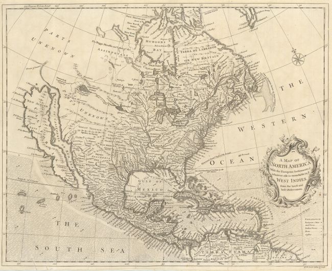
Attractive map based on Popple's seminal map of 1733. It is one of the last maps to show the island of California although Seale incorporated some information from Kino in the Southwest. He also continued to portray fanciful details from Baron Lahontan's romantic tale of his 1688-90 travels west of the upper Mississippi River with the Longue River stretching to the Rocky Mountains. The Straits of Anian are noted, but most of the northwest is marked Parts Unknown and contains little data. Shading designates the trade winds with directional arrows showing the course of the winds. The routes of the Spanish galleons are marked in the Caribbean. Includes an ornate title cartouche and compass rose.
References: McLaughlin #228; Tooley (Amer) p. 134, #97; Wheat #124 & 202.
Condition: B
The map has been backed with apparently archival paper repairing a few small tears at edges, a couple of which just enter map. Margins trimmed, but still adequate for framing.