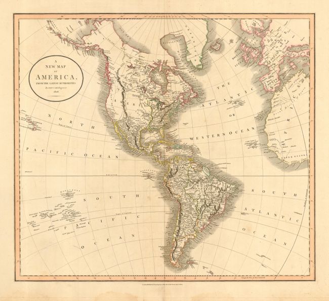
Subject: Western Hemisphere
Period: 1806 (dated)
Publication:
Color: Hand Color
Size:
20.5 x 18 inches
52.1 x 45.7 cm
Large map of the Americas with a rudimentary shape for Alaska, here called Aliaska. The United States is shown confined east of the Mississippi River. The western part of North America is bisected by a huge mountain range labeled The Stony Mountains and is shown as completely unexplored with a few suspected rivers delineated by dotted lines. Map extends to show the Sandwich Islands, Britain and Europe, and western Africa.
References: Phillips (A) #714-50
Condition: B
Crisp impression and original hand coloring in outline. Wide, original margins on thick paper. A few small spots in map, else very good. A little marginal staining, away from map image.