Subject: World
Period: 1720 (circa)
Publication: Atlas Coelestis
Color: Hand Color
Size:
22.6 x 19 inches
57.4 x 48.3 cm
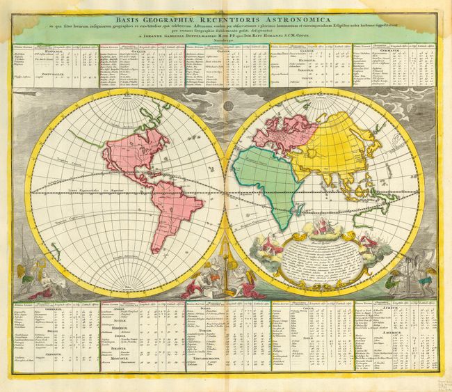
First state of this scarce world map combining both scientific and decorative cartography. The continents are shown in outline form without political detail. California is an island, only the western and northern coastlines of Australia are shown, and New Zealand is incomplete. There is a hint of a possible Northwest Passage from Hudson Bay to the Strait of Anian. The map is richly decorated with a large allegorical cartouche and surrounded by celestial phenomena, including a comet, and solar and lunar eclipses. Three groups of cherubs are shown making astronomical observations. Above and below the map are tables naming major cities throughout the world with their respective longitude, latitude, celestial observations and eclipse information.
References: Shirley (TMC-46) pp. 34-38.
Condition: B
Strong impression and lovely original color with some centerfold toning, and water stains at both upper corners.