Subject: Exploration - Japan
Period: 1856 (published)
Publication:
Color: Black & White
Size:
7 x 10 inches
17.8 x 25.4 cm
A complete first edition of this historical work that documents, in text, maps and profuse illustration, this important expedition. This expedition established relations between the United States and Japan. Perry established a treaty in 1854 that required that ship-wrecked sailors in Japanese territory be treated humanely, and that coal would be sold to U.S. ships. It also opened the port cities of Shimoda & Hakodate to U. S. commerce, ending 400 years of Japanese isolation.
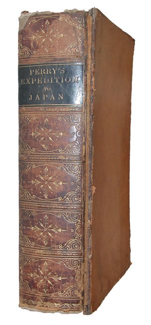
Compiled by Francis L. Hawks and published by Appleton and Company, three volumes in one. Contents: frontispiece (Prince of Idzu), title page, Prefatory Note, Errata & List of Illustrations Wrongly Lettered, Letter of the Secretary of the Navy, Introduction, Appendix, Index. 624 pp. includes scores of illustrations, plus maps, charts and drawings, many with original tissue guards. This edition does not contain the suppressed "Public Bath at Simoda" plate. Maps include: "Chart showing the track of the Flagships of the U.S. Japan Expedition to the Eastd. of the Cape of Good Hope 1853 & 1854" (16" x 10.5") binding side tear, folding as issued; "Great Lew Chew and its dependencies" (8" x 6") folding; "Island of Great Lew-Chew" (8" x 6") folding; "Chart of the Harbor of Napha Lew Chew Id." (12.7" x 8.7") folding; "Bay of Yedo..." (9" x 12.8") folding; "Map of the Japan Islands copied from von Siebolds..." (14" x 12") two tears and a little toning, folding; "Chart of the Bonin Group of Islands" (6.5" x 8.6") folding; "Simoda Harbor Id. of Nippon" (11.5 x 9") folding; "Chart of the Kuro Siwo or Japan Stream of the Pacific Analogous to the Gulf Stream of the Atlantic" (12" x 9") folding; "Makadadi Harbor" (12" x 9") folding; and "The Island of Formosa" (6.5" x 9") folding. Hardbound in full leather with tooled and gilt spine. Back board with quarter calf and marbled paper over boards with marbled endpapers and all edges.
References: Sabin #30968.
Condition: B
Back cover separated from spine, front cover starting. Occasionally underlining in ink to text. Contents generally good to very good, signatures tight.