Antique Maps, Charts, Atlases and Globes for Sale at Auction

Old World Auctions - Antique Map Specialists


Antique Map Auction Sale No. 111 - closed 6/8/2005

Featuring 788 lots of rare antique maps, charts, pocket maps, globes and atlases
Prices Realized       Table of Contents       Search Auction


Lot #166: "Washington and Oregon" Joseph Hutchins Colton

Antique map chart Washington and Oregon
Click to see full size image(s)

Estimate:
$200.00 - $250.00
Sold for: $300.00

Lot 166
By: Joseph Hutchins Colton
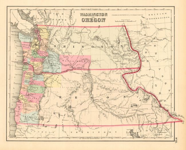
Subject: United States - Northwestern
Date: 1857

Publication: General Atlas

Condition: A
See Condition Guidelines

Color: hand color

Size: 14.5 x 11.7 inches
36.9 x 29.8 cm

A great map of the Pacific Northwest showing both territories extending to the Continental Divide and that region that would become Idaho. Of specific interest is the notation of all the major exploration routes, wagon trails and the proposed routes for the transcontinental railway as explored by Gov. Stevens. This is an early edition with only a few organized counties confined to a narrow band along the coast.

A very nice example with full, original margins on supple paper. Fine original coloring.

See on Map Price Guide | See similar on Map Price Guide
Search this archived auction | Antique Map Price Guide