Antique Maps, Charts, Atlases and Globes for Sale at Auction

Old World Auctions - Antique Map Specialists


Antique Map Auction Sale No. 111 - closed 6/8/2005

Featuring 788 lots of rare antique maps, charts, pocket maps, globes and atlases
Prices Realized       Table of Contents       Search Auction


Lot #103: "A Plan of the Straits of St. Mary, and Michilimakinac, to Shew the Situation & Importance of the two Westernmost Settlements of Canada for the Fur Trade" Anonymous

Antique map chart A Plan of the Straits of St Mary and Michilimakinac
Click to see full size image(s)

Estimate:
$350.00 - $400.00
Sold for: $350.00

Lot 103
By: Anonymous
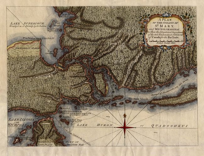
Subject: Colonial Great Lakes
Date: 1761

Publication: London Magazine

Condition: A
See Condition Guidelines

Color: hand color

Size: 12.6 x 9.3 inches
32.0 x 23.7 cm

Uncommon map of the region where the fur trade flourished during the colonial period. Mackinac and Sault Ste. Marie each commanded a narrows in the Upper Lakes system, thus exercising great influence in the fur trade and became strategic sites for military activity. The map is densely engraved to depict the mountainous and forested landscape and filled with interesting notations concerning the Indian inhabitants. Locates the Mission of St. Mary and Mission of St. Ignace, as well as the "Common Track of the Vessels to the Detroit &c." Lake Superior is noted as "Worship'd as a Divinity by the Indians." Decorated with a delicately engraved title cartouche and a fleur-de-lis.

Trimmed to neatline at bottom and remargined.


Ref: Jolly LOND-197; Sellers and Van Ee #770.

See on Map Price Guide | See similar on Map Price Guide
Search this archived auction | Antique Map Price Guide