Subject: Colonial Great Lakes
Period: 1755 (dated)
Publication:
Color: Hand Color
Size:
21 x 16.5 inches
53.3 x 41.9 cm
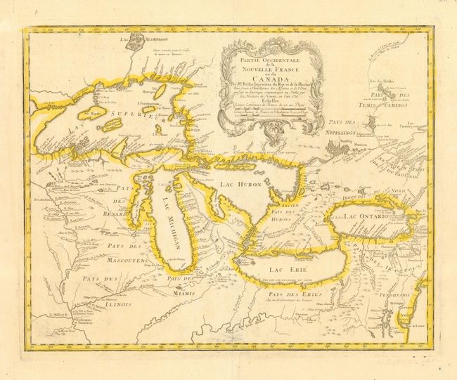
Superb map of the Great Lakes region illustrating strategic forts and the area claimed by the French just prior to the French and Indian War. Bellin's map, first published in 1744, dominated the cartography of the Great Lakes region for many years. Four fictitious islands appear in Lake Superior, including the infamous I Philippeaux Aut. I Minang that continued to appear on maps, and eluded explorers' searches for it, well into the 19th century. This issue was published by Homann Heirs.
References: Karpinski, (MI) p.138; Kershaw #950; Schwartz & Ehrenberg plt. 97.
Condition: A+
Fine impression and original color. Bit of printer's ink residue in plate.