Antique Maps, Charts, Atlases and Globes for Sale at Auction

Old World Auctions - Antique Map Specialists


Antique Map Auction Sale No. 110 - closed 3/2/2005

Featuring 771 lots of rare antique maps, charts, pocket maps, globes and atlases
Prices Realized       Table of Contents       Search Auction


Lot #662: "Loanda S. Pauli" Olivier Dapper

Antique map chart Loanda S Pauli
Click to see full size image(s)

Estimate:
$110.00 - $150.00
Sold for: $110.00

Lot 662
By: Olivier Dapper
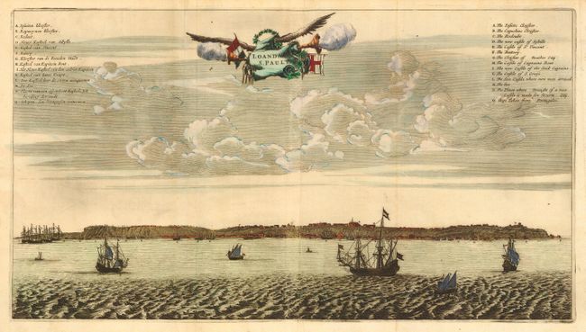
Subject: Africa - Western
Date: 1670

Publication:

Condition: A
See Condition Guidelines

Color: hand color

Size: 19.7 x 11 inches
50.1 x 28.0 cm

Attractive coastal view of the island of Luanda (Angola). The name means "flat land" as the island has no mountains and is comprised only of sand deposited by the Kwanza river. The island was colonized by the Portuguese in 1575 and became a major center for the slave trade. Between 1641 and 1648, the city was occupied by the Dutch, which is the period depicted here. Keys in upper corners in both Dutch and English. On two joined sheets, as issued.

Impression is a bit uneven at joint, else fine.

See on Map Price Guide | See similar on Map Price Guide
Search this archived auction | Antique Map Price Guide