Catalog Archive
Auction 110, Lot 567
"Nouvelle Carte de l'Asie avec des Tables Alphabetiques pour Trouver sans Peine les Etats des Principaux Princes de Cette partie du Monde. Une Cable des Villes Principales et Quelques Remarques pour l'Intelligence de l'Historie d'Asie", Chatelain, Henry Abraham
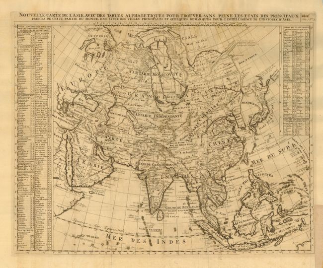
Subject: Asia
Period: 1705 (circa)
Publication: Atlas Historique et Methodique
Color: Black & White
Size:
22.7 x 18.5 inches
57.7 x 47 cm
Download High Resolution Image
(or just click on image to launch the Zoom viewer)
(or just click on image to launch the Zoom viewer)