Subject: Arizona
Period: 1910 (dated)
Publication:
Color: Printed Color
Size:
16.5 x 20.2 inches
41.9 x 51.3 cm
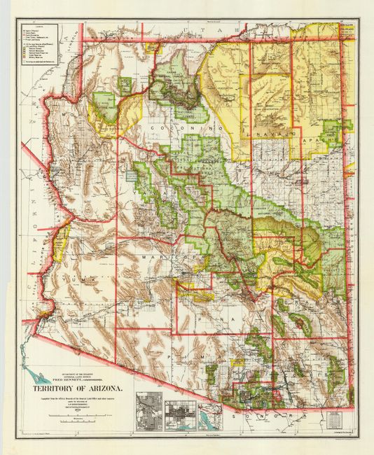
A very colorful map that provides a detailed look at the territory less than two years before statehood. The plate for this map has been completely re-engraved from earlier maps. It now features city plans in insets for Phoenix and Tucson. The map details the extent of National Forest (not Forest Reserves as on previous maps), Indian Reservations, and Military Reservations. Also includes the new categories of National Monuments and National Game Preserves. Good detail of the large number of railroads of the day. Private claims are now shown, without mention of confirmed and unconfirmed, and are outlined in red. The Grand Canyon Forest Reserve is shown. The strong use of colors gives this map a strong visual impact. Details include watershed, mountains, railroads, wagon roads, private claims, unsurveyed townships, and much more.
References:
Condition: A+
Folding, as issued.