Catalog Archive
Auction 110, Lot 146
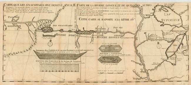
"Carte que les Gnacsitares ont Dessine sur ... Carte de la Riviere Longue et de quelques Autres qui se Dechargent dans le Grand Fleuve Missisipi …", Lahontan, Louis Armand
Subject: Colonial Midwest
Period: 1703 (circa)
Publication: Nouveaux Voyages de M. le Baron de Lahontan dans l'Amerique Septentrionale
Color: Black & White
Size:
26.2 x 11 inches
66.5 x 27.9 cm
Download High Resolution Image
(or just click on image to launch the Zoom viewer)
(or just click on image to launch the Zoom viewer)