Subject: Colonial Canada and United States
Period: 1753 (circa)
Publication:
Color: Hand Color
Size:
14.5 x 13.5 inches
36.8 x 34.3 cm
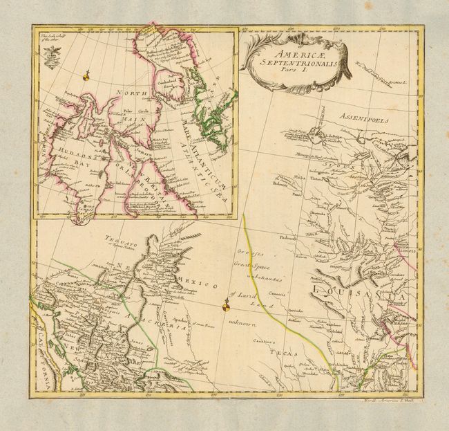
This scarce map covers the region from the Mississippi River valley through the present-day American Southwest. It presents a detailed view of French Louisania and the Spanish possessions in New Mexico with a Great Space of Land Unknown and Tecas in between. A notation on a river flowing into Lake of the Woods (The Wood Lake) remarks, "Great River coming from the West discovered lately by the Oshages Savages." A large inset map illustrates Hudson and Baffin bays with numerous notations concerning discoveries in the region. Notations are in English.
References:
Condition: B
Map is trimmed to neatline and pasted to a sheet of nineteenth century French paper, probably for inclusion in a composite atlas. Scattered foxing on back sheet. Couple of printer's creases in map.