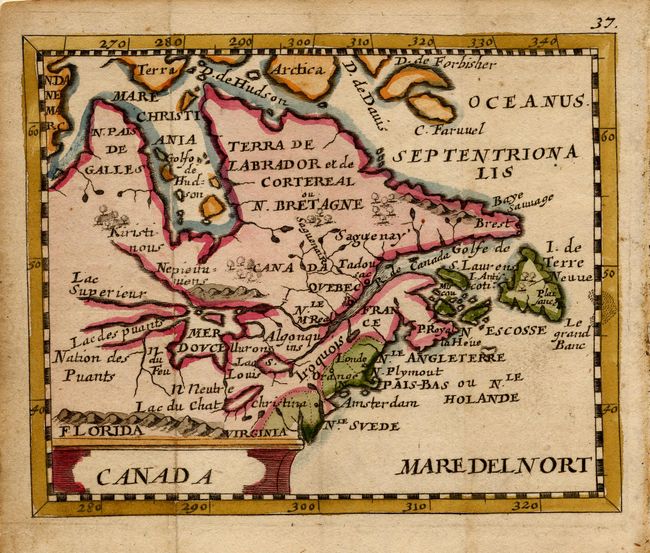
Subject: Colonial Great Lakes and Canada
Period: 1679 (published)
Publication: Geographiae Universalis…
Color: Hand Color
Size:
4.8 x 4 inches
12.2 x 10.2 cm
This little map is derived from Sanson's influential Le Canada ou Nouvelle France of 1656. The map is centered on the French possessions in North America with emphasis on the Great Lakes. Lake Superior and Michigan are shown with open-ended western shores and Lake Erie (Lac du Chat) is located too far south. In northern Canada a sea route is shown through the northwest part of Hudson Bay. The British, Dutch and Swedish colonies are depicted along the eastern seaboard from Virginia to I. de Terre Neuve.
Pierre Duval was Nicolas Sanson's nephew and pupil. He published a wide range of atlases and individual maps including a fine miniature world geography with many of the maps based on Sanson. This map is from the German edition of Duval's world geography. The maps were probably engraved by Sigismund G. Hipschman (as his signature appears on the title page and the world map) and have Latin titles rather than the original French. The maps are often attributed to Johann C. Beer, who translated the work into German.
References: Burden #351; Kershaw #142.
Condition: A