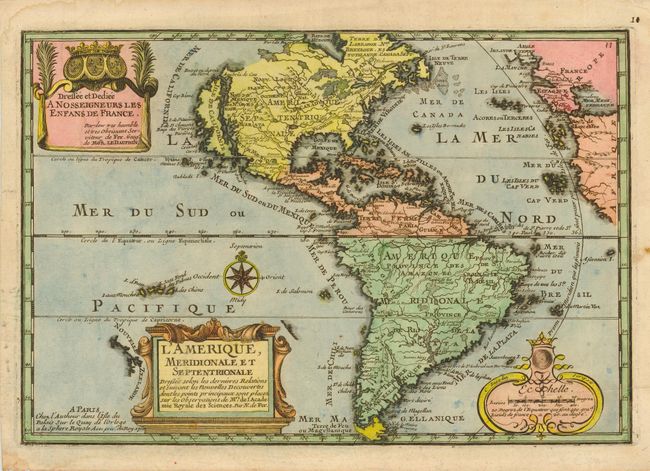
Subject: Western Hemisphere
Period: 1700 (dated)
Publication:
Color: Hand Color
Size:
13.2 x 9 inches
33.5 x 22.9 cm
A charming map of the Americas with the island of California covering the entire west coast north of the Tropic of Cancer with two large imaginary islands off shore. One of the prominent features in northern Mexico is Les Mine de S. Iean et de Ste. Barbe, the legendary Santa Barbara mines of the Chihuahua-Durango region. There are several large spurious lakes on both continents. A partial coastline of New Zealand appears beside the title cartouche. The map is richly decorated with three cartouches and a compass rose. This is the first state.
References: McLaughlin #135, Tooley (America) #61; Leighly #105.
Condition: A
Light damp stains and spots in blank margins.