Subject: Colonial Canada & United States
Period: 1755 (dated)
Publication:
Color: Hand Color
Size:
19.7 x 24 inches
50 x 61 cm
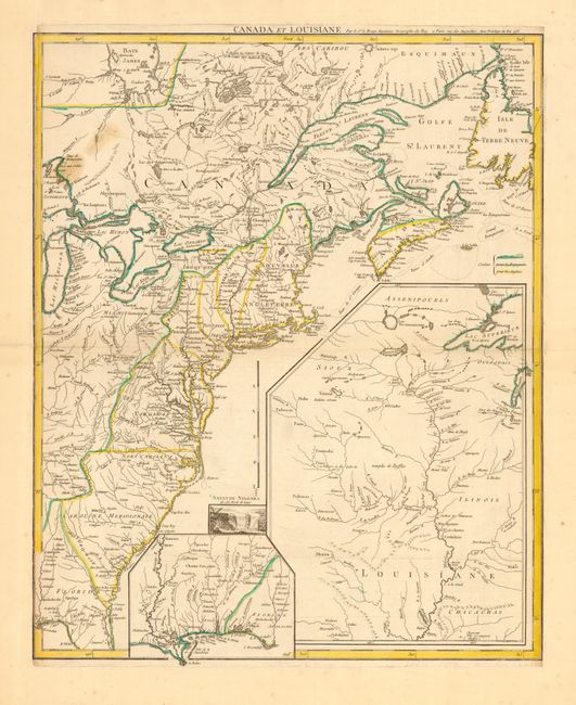
This important map was issued at the outbreak of hostilities in the French and Indian War. The map depicts the entire eastern seaboard and the Great Lakes up to Lake Michigan with a great amount of detail. The American interests of France, England and Spain are shown in great detail and color-coded. Fort Duquesne is shown in two different places on the map - according to D’Anville and Jefferys. A large inset shows the upper Mississippi River valley with the important frontier forts. A smaller inset shows the lower Mississippi and Gulf Coast. A small vignette of Niagara Falls adds further interest to this fascinating map. This is the first state of four. The later issues have revised titles.
References: McCorkle #755.23; Sellers and Van Ee #33.
Condition: B
A couple of spots in upper left area of map. Trimmed to neatline and completely remargined.