Subject: North America
Period: 1824 (published)
Publication: A New General Atlas
Color: Hand Color
Size:
8.7 x 11.3 inches
22.1 x 28.7 cm
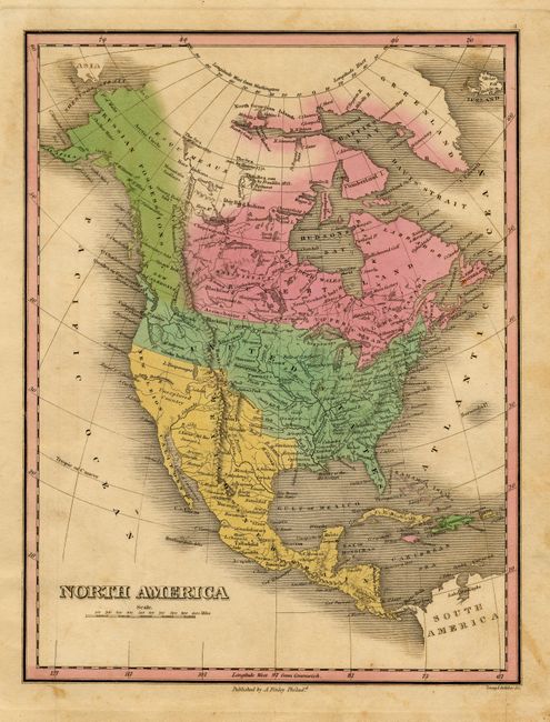
Finely's maps employ a delicate and elegant engraving style and provided extensive topographical and watershed information. He was the dominant map maker in the United States in the early 1820s into the 1830s. His atlases were very successful, outselling rival atlases by Carey & Lea, and Tanner. His maps were printed on high quality paper and were routinely corrected and updated.
Fine pastel full-wash coloring depicts national claims. Russian Possessions extend from Alaska all the way into British Columbia, the southern portion here named New Caledonia. The United States extends to Oregon Territory and the Canadian/U.S. border is left blank in the west. Numerous Indian tribes are located. LLake Timpanogosis large and extends into Snake Indian territory in today's Idaho. L. Salade is the source of the Buenaventura River that flows into the Pacific at San Francisco, here called the Bay of Sr. F. Drake. The Great Basin is labeled Unexplored Country. Canada is labeled Rupert's Land. A very nice example of a map that is increasingly scarce. Well engraved by Young & Delleker.
References:
Condition: B
Very good impression on thick paper. Trace of scattered foxing in blank areas, else very good.